Joplin: Looking Back on a Monster
Monday marks six years since an EF-5 tornado devastated the city of Joplin, Missouri. We’re recapping a defining day in weather history.
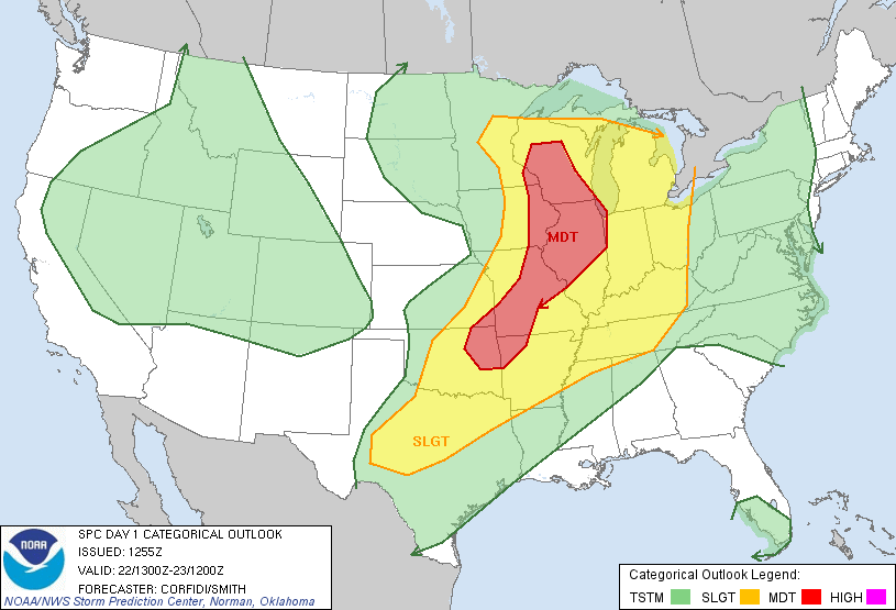
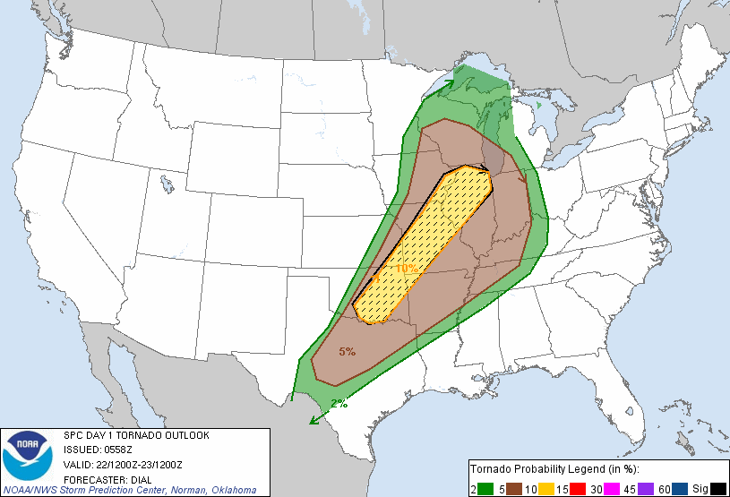
Around breakfast-time on the 22nd, the Storm Prediction Center issued a “moderate risk” thunderstorm outlook with a significant risk for tornadoes. Throughout the day of the 22nd, conditions for tornadoes improved and the forecast for tornadic storms rapidly became a reality.
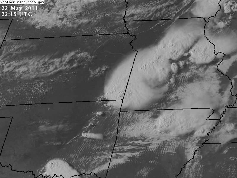
At 5:34 pm CDT on May 22nd, 2011, a small tornado touched down close to the Kansas/Missouri state line, and started moving east. Over the following 38 minutes, the tornado went on to inflict unprecedented damage and directly claimed 158 lives.
Build-Up
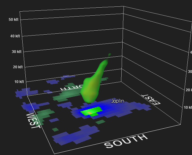
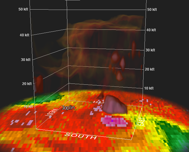
National Weather Service warnings reached Joplin 20 minutes ahead of the tornado’s arrival; radar imagery having indicated strong rotation in the storm. In around ten minutes, the initial small tornado became a mile-wide wedge.
“My cousin at the time was living in NW Arkansas and I texted her about an hour before the Joplin tornado”, says Meteorologist Kate Crouch who was on shift at the time. “I told her these tornadoes are spinning up quickly, so be on the lookout”.
Kate’s forecast that was delivered to clients earned praise in AccuWeather Enterprise Solutions Sr. VP Mike Smith’s book on the Joplin tornado.
The Tornado Strikes Joplin
This tornado intensified at an incredible pace. A messy cluster of strong storms was pushing east, in an environment where anything had the potential to become tornadic.
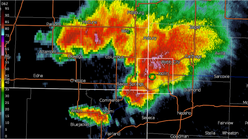
The twister pushed towards Joplin at EF-1 intensity but strengthened to an EF-2 or EF-3 as it roared into the city’s southwestern suburbs. Though still significantly weaker than it’s peak strength, the tornado destroyed several homes by throwing or rolling vehicles through them.
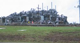
The tornado progressed further into the city and began producing extensive EF-4 and EF-5 damage. In the area around the St. John’s Regional Medical Center, 300 lb, anchored concrete blocks were lifted and thrown 60 yards – a feat that required winds well in excess of 200 mph.
The hospital itself was a very well constructed building, unlike many nearby structures. Despite the quality of construction, the force of the tornado was so great that the foundation itself was compromised, meaning the hospital had to be torn down.
In a heroic but tragic feat, Pizza Hut store manager Christopher Lucas took his staff and customers to shelter in the freezer. Since locking the freezer door would have trapped everyone, he tied the door shut using a bungee cord and his own arm. The tornado hit the restaurant at peak strength. Mr. Lucas was sucked into the tornado and killed, saving the rest of the group with his actions.
Aftermath
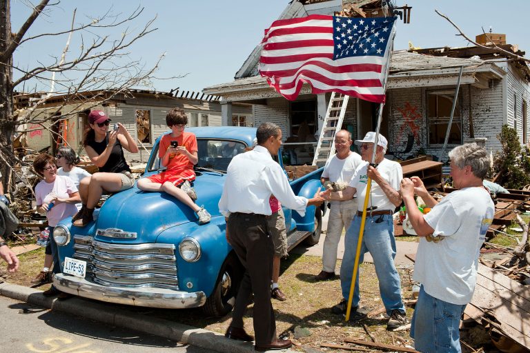
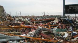
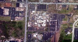
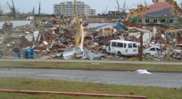
The city’s emergency manager estimated between 10% and 20% of the city was destroyed. Damage was so extensive that many residents who lost vehicles were never able to locate them. Final losses were estimated at $2.8bn.
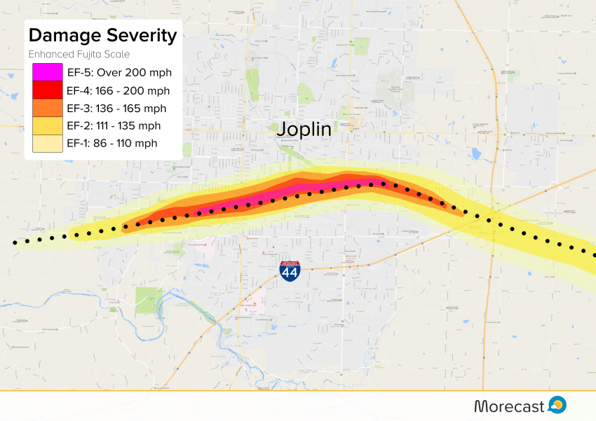
A subsequent engineering study actually disputed the EF-5 strength, referencing the generally poor construction of buildings in the city. The National Weather Service survey teams found several non-conventional damage indicators, however.
Severe damage to flat surfaced driveways, removal of manhole covers, as well as large vehicles being thrown hundreds of yards, meant the top rating for the twister stood.
The tornado remains the most deadly since the Woodward, Oklahoma storm in 1947, and the seventh deadliest of all time.
You can look through this gallery of pictures from the storm and the aftermath.

For more feature articles and the latest severe weather news and updates, connect with us on our Twitter and Facebook feeds.
