Severe Storms set to batter the Plains and Southeast Thursday

A strong surface boundary has moved northwest into Central Kansas with a dry line extending south into the Texas panhandle. Dew points ahead of this system are currently in the low 70’s.
Severe Weather Details:
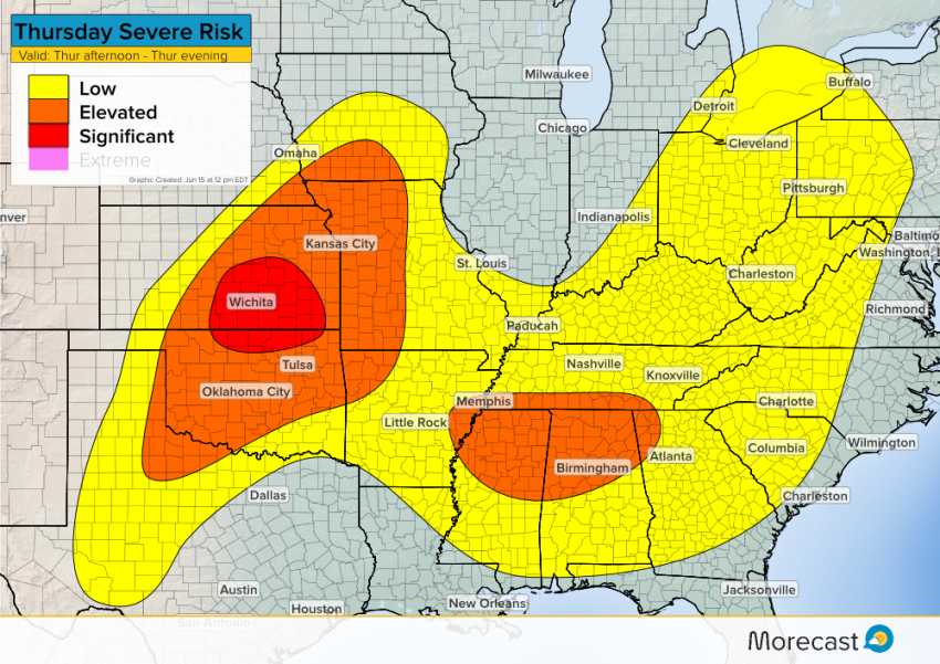
With mostly clear skies early Thursday afternoon, ample surface heating will allow for severe thunderstorm development. Storms are anticipated to fire between 1PM and 2PM CDT and could become severe quickly.
The main hazards will be large hail that could exceed 2 inches in diameter, and damaging wind gusts. Conditions do not favor tornado development but there is an isolated risk.
Across the Southeast, ongoing storms Thursday morning will weaken by early afternoon. As conditions clear out, redevelopment is possible across the area. The main hazards will not be as significant as those in the Plains, but isolated damaging wind gusts and small hail may occur as well as frequent lightning.

If weather conditions are safe, upload your photos to the Morecast App. Feel free to following along on our social media platforms Facebook and Twitter as well as Morecast.com for the latest updates.
