UPDATE: Scattered Severe Storms Still a Threat for the Upper Midwest : Thursday, July 6th

An upper level disturbance is dropping into the Upper Midwest from the Canadian Prairies today. It’ll encounter unstable air by the afternoon hours, setting the stage for storms. Severe cells will break out in the late afternoon and move southeast towards Milwaukee and potentially Chicago this evening.
There are still questions about how widespread severe storms will be with this event. The ingredients are all there, but if timing is off then coverage of storms could be sparse. Where severe storms develop, expect damaging wind gusts to 70 mph and large hail to two inches in diameter. An isolated tornado can’t be ruled out of the question, either, especially in central Wisconsin.
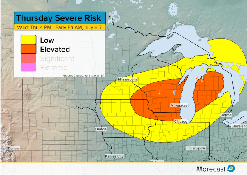
Right now it appears that Milwaukee stands a good chance of seeing severe storms by mid-evening with strong winds the prime threat. At this time it appears Chicago will not see the strongest storms. However, storms approaching by the late evening hours could still produce small hail, gusty winds, and briefly heavy rain.
Look for additional updates on Morecast.com along with our Twitter and Facebook feeds as this severe storm event unfolds.
