Tropical Storm Emily Bearing Down on Tampa Bay! July 31
Tropical Storm Emily is making landfall late this Monday morning on the south side of Tampa Bay. Gusty winds, heavy rains, and isolated tornadoes will threaten the southern half of the Florida peninsula through tonight.
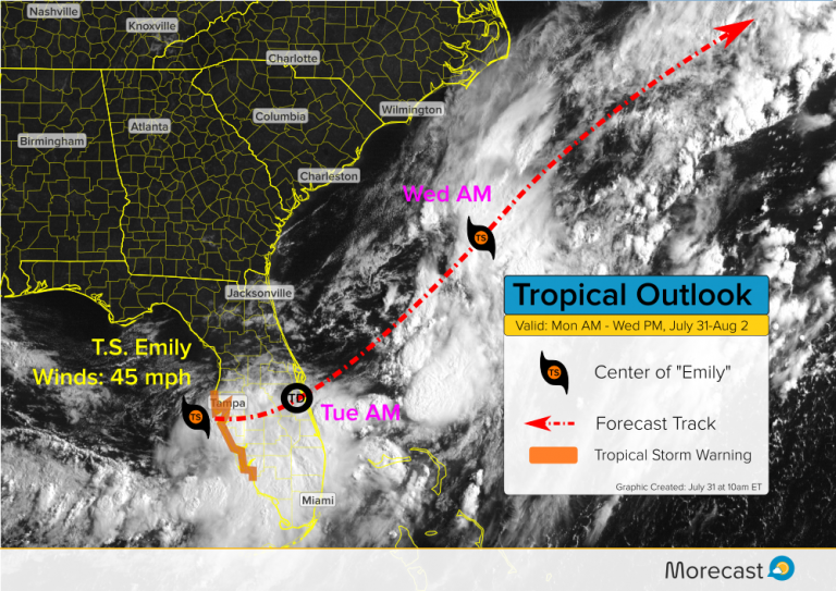
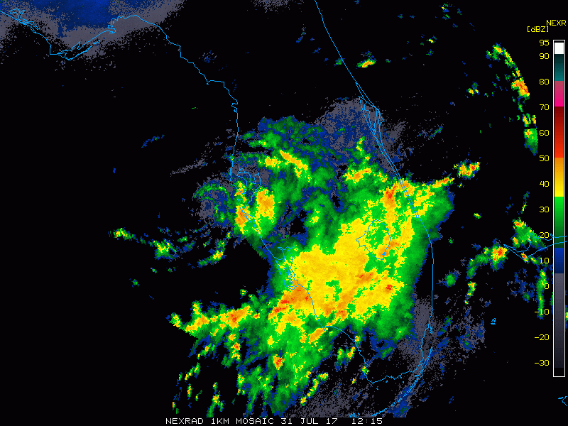
Emily developed rapidly overnight from a cluster of storms in the warm Gulf waters just off the Florida coast. Radar imagery this morning shows a well-developed spin (see below). However, the storm is lopsided, with almost all the heavy winds and rains occurring on the southeast side. A tropical storm warning is in effect from around Tampa down the coast to Naples, Florida.
Emily will continue to move east across the central Florida peninsula through today and tonight, emerging over the open Atlantic on Tuesday before moving northeast. Heavy rain locally up to 5-7 inches will lead to flash flooding over the southern half of the peninsula. Gusty winds up to 50 mph will largely be confined to the Gulf coast. A few isolated tropical tornadoes could also occur. Storm surge will be relatively minor, but some inlets could see 1-2 foot higher tides than normal.
The storm will likely weaken somewhat as it crosses land. However, it will encounter favorable conditions for reintensification on the Atlantic side and could become a tropical storm again. Emily will move northeast but stay off the coast of the Carolinas before heading out to sea later this week.
We’ll continue to watch Emily closely and send out updates as needed. Stay tuned to our Twitter and Facebook feeds as well as Morecast.com for the latest!
