Lessons Learned from Devastating Superstorm Sandy
In the last days of October 2012, meteorologists knew that a powerful storm threatened the densest population center in the United States. Hurricane Sandy had already plowed through portions of the northern Caribbean, causing billions of dollars worth of damage and claiming dozens of lives. Now the models suggested an unusual turn, not away from but towards the U.S. east coast. Forecasters worked frantically with emergency officials to make sure the public had all the information they needed to make life-and-death decisions.
But the severity of the storm still caught many off guard. Weather forecast agencies came under immediate criticism. Attempts to spread critical information had been hampered by faults in warning procedure and coordination. Unfortunately, these issues were exposed only by the pressure of a real emergency situation.
Sandy acquired several catchy if hyperbolic titles as it rolled towards the Northeast coast, including “Snowicane”, “Snor’eastercane”, and “Frankenstorm”. “Superstorm” was the one that stuck, even to the point of being used on government documents. But Sandy only had two official designations: “hurricane” and, later, “post-tropical cyclone”. That rather mundane latter term refers to a system that has transitioned from warm-core to cold-core. The difference lies in how the system gains energy. Warm-core systems (like hurricanes) tap energy directly from the warm tropical oceans. Conversely, cold-core systems (like nor’easters) draw strength from sharp temperature contrasts between air masses (i.e. warm and cold fronts). Virtually all tropical cyclones undergo the warm-to-cold transition as they move north, if they don’t dissipate first. However, most do it as they’re weakening over the open ocean.
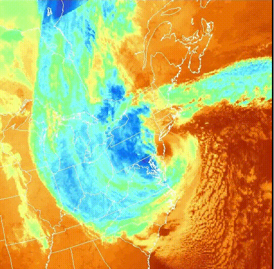
Infrared Satellite loop from 29-October, 2012
Sandy was another story. Thanks to a merger with a strong upper level trough over the eastern U.S., Sandy actually gained power as it transitioned from tropical to post-tropical cyclone. In effect, it helped itself to portions of both warm- and cold-core energy sources. It also increased greatly in size, a major contributing factor to the storm surge that devastated long stretches of the East coast.
This ambiguity in terms is much more than a quibble about semantics. Thousands of insurance customers stood to save millions in insurance deductibles only due if the storm was still officially a hurricane at landfall. On the other hand, the lack of hurricane warnings and the drab “post-tropical cyclone” designation may have suggested that Sandy was less of a threat, resulting in a greater loss of life. Indeed, it may have influenced emergency preparations in New York City in this way. Mayor Bloomberg downplayed the impacts of the storm there in his initial media briefing. He only ordered mandatory evacuations as the storm was moving in.
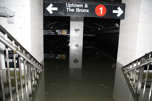
A flooded subway station in Lower Manhattan. Courtesy MTA
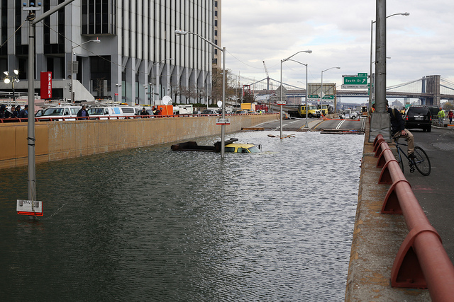
The Battery Tunnel entrance underwater. Courtesy flickr user Timothy Krause
Prior to Sandy, jurisdiction over tropical vs. post-tropical cyclones was split between the National Hurricane Center and another group of agencies (including the National Weather Service), respectively. In the case of Sandy, the NHC had no license to issue hurricane warnings even though there was as much potential for destruction and loss-of-life as any hurricane. Warning messages from the NWS and other agencies covered the full range of impacts (winds, flooding rains, storm surge) well in advance. However, they didn’t possess the same weight and credibility as a National Hurricane Center hurricane warning.
In response to internal analysis and public and media criticism, the NWS, NHC and other agencies reorganized their procedures. The hurricane center can now issue warnings for hurricane-force conditions regardless of whether the cyclone is tropical or post-tropical. The goal is to ensure continuity of the warning messages. The disaster also spurred NOAA forecasters to greater participation in social media, encouraging a maximal outreach in severe weather emergencies.
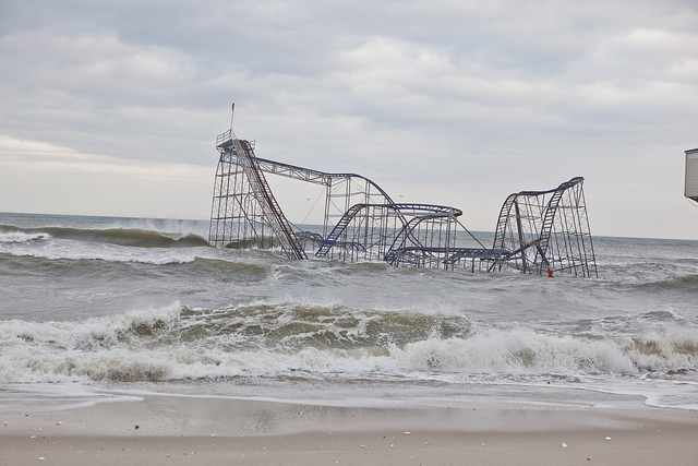
Lead image courtesy: flickr user Anthony Quintano
