Another East Coast Storm Threat Next Week

March has already brought three intense nor’easters to the East Coast, and now a fourth storm may be brewing.
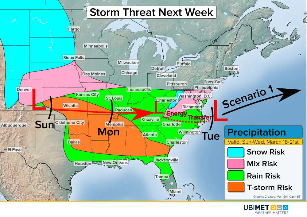
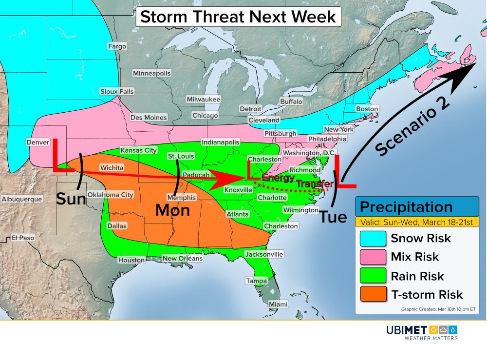
Low pressure will emerge from the Colorado Rockies on Sunday and track into the Tennessee Valley Monday. Beyond Monday, low pressure will redevelop off of the North Carolina coast and threaten the Mid-Atlantic and Northeast.
Along and south of the storm track, an area of rain and thunderstorms will break out. There is a risk for isolated severe weather across the south-central Plains Sunday afternoon. The threat for some gustier thunderstorms will spread across portions of Mississippi, Alabama, and Georgia on Monday afternoon.
Meanwhile, to the north of the low track a cold rain will could mix with snow at times.
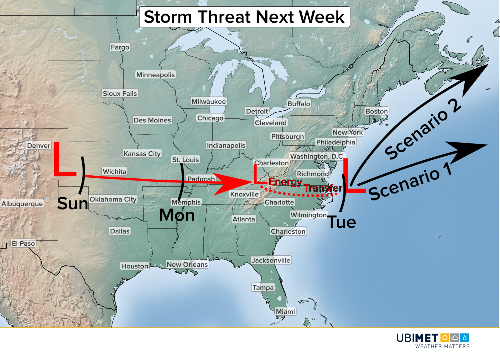
2 Scenario Next Week
As low pressure approaches the southern Appalachians on Monday, a second area of low pressure will develop near the North Carolina coast. The location and movement of the second low are crucial to potential impacts across the Mid-Atlantic and Northeast.
The first scenario would feature a storm track to the east-northeast out to sea. In this scenario, a wintry mix of rain and snow could impact interior Virginia. However, much of the Northeast would remain dry.
The second scenario would feature a slightly stronger low pressure system that would take a more northeasterly track. A track closer to the Northeast coast would bring a greater risk of precipitation. Cold air is expected to be in place, so much of the precipitation would likely fall as Snow or a rain/snow mix.
A favored scenario in the track of low pressure is expected to emerge by the end of this weekend.
