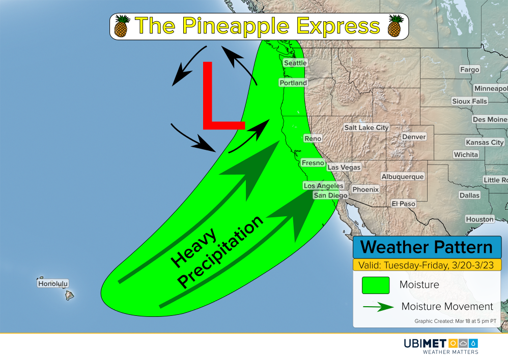
“Pineapple Express” Event Looming for California, West Coast This Week

The West Coast will be bracing for a prolonged period of heavy precipitation this week from a phenomena known as the “Pineapple Express”. Flooding rain along the coast and hills as well as heavy mountain snow will threaten some communities, especially in California.
Pineapple Express in weather refers to a river of abundant moisture that originates in the tropical Central Pacific and moves up into the west coast of the United States.
What to expect:
Steady precipitation looks to arrive in California on Tuesday and then become heavier and more widespread Wednesday and Thursday. Drier weather will move into southern California on Friday, but unsettled weather will remain farther north.
The mountains of southern California as well as the Sierras look to receive the heaviest precipitation through the end of the week. 4-8 inches (100-200 mm) of rain is possible for elevations between 500-5,000 feet (~150-1,500 meters).
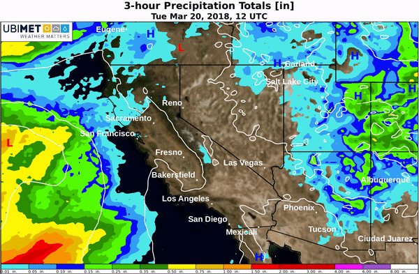
The major cities along the I-5 corridor will also be susceptible to bouts of heavy rain. Los Angeles looks to take the brunt of the heaviest rain with 2-4 inches expected over a 3-day period.
Flash flooding and mudslides will be a concern, particularly in the hills and across recent burn areas from wildfires.
Across the Sierras above 5,000 feet, 2-4 feet (60-120 cm) of snow is likely to fall. Snow levels across southern California will be closer to 9,000 feet (~2,700 meters), which is above most mountain peaks.
Drought Relief:
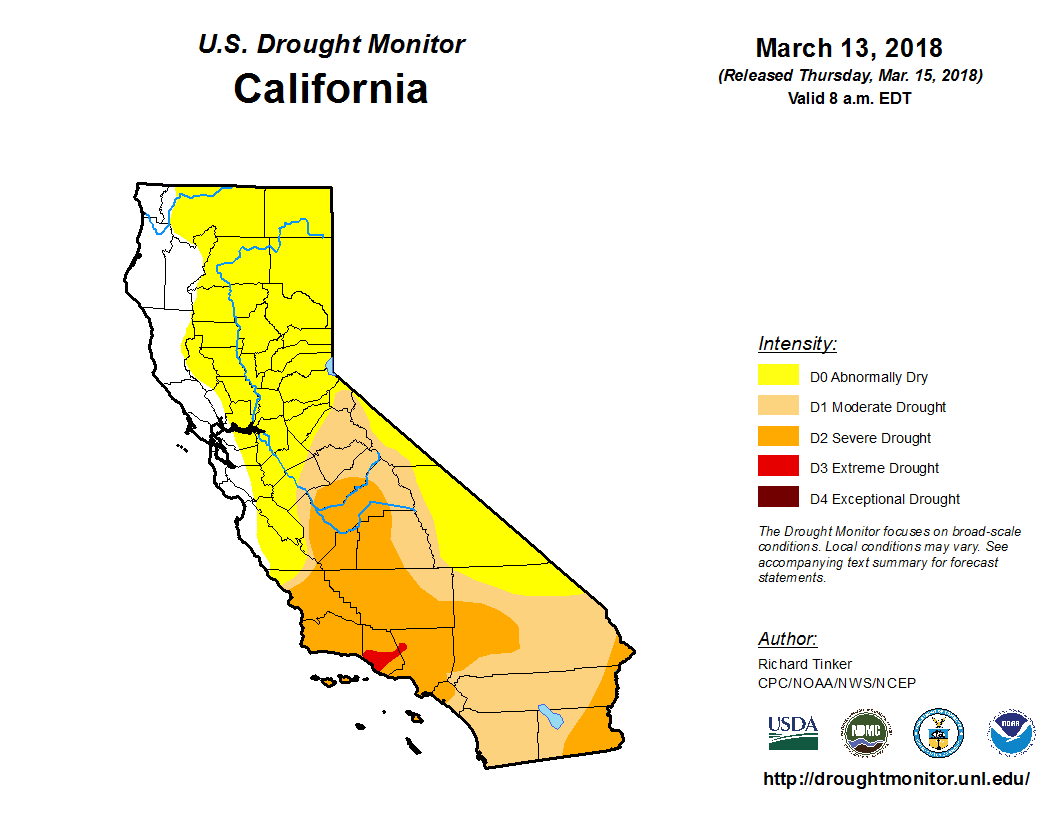
Much of California remain in some form of a drought, with severe drought conditions across portions of southern California. The expected rainfall will be good news for the drought relief, despite the flooding risk mentioned above.