Wildfire Danger in the High Plains Early This Week!
After a brief cool-down, gusty southwest winds are pushing temperatures quickly back up over the Southern Plains. Temperatures which started Sunday morning in the 20s over the Texas Panhandle have jumped back up to near 90 degrees on Monday afternoon. Meanwhile, southwest winds are gusting up to 40 mph, combining with months-old drought to produce a dangerous wildfire threat.
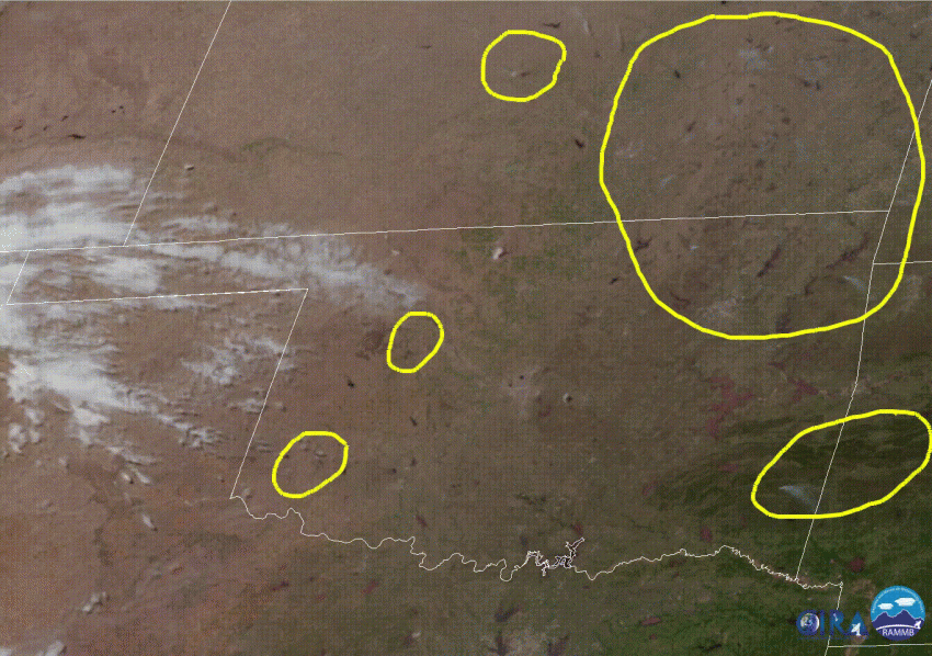
As you can see in the satellite animation below, wildfires are breaking out in many areas. These are distinguished by their plume-like appearance, contrasted with the fast-moving, elevated clouds to the west. Many of the plumes in the upper right of the picture (southeast Kansas and northwest Oklahoma) are probably controlled burns. However, the two plumes that appear late in the loop over western Oklahoma are certainly wildfires.
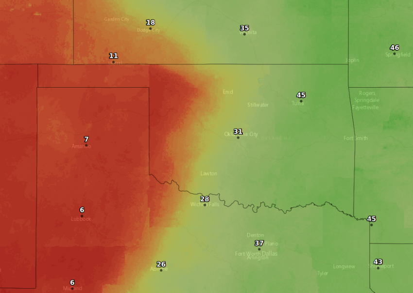
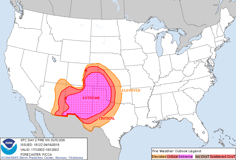
The situation looks even worse for Tuesday. The map below shows forecast humidity values for Tuesday afternoon, at or below 10% from western Oklahoma into the Texas Panhandle and further west. Winds will increase with gusts of 50-60 mph, and temperatures will again approach or exceed 90 degrees. The result: a historically large wildfire risk (see graphic at bottom from the Storm Prediction Center who handles fire forecasting). Any fire sparked in this region will be very likely to run out of control, threatening homes and businesses. An elevated fire risk will still exist on Wednesday and beyond, however the region affected should shrink back to desert areas of New Mexico and west Texas.