Subtropical Storm Alberto Makes Landfall in the Florida Panhandle!
Alberto continues to track north away from the landfall point, which occurred near Laguna Beach, Florida around 5 pm EDT (4 pm CDT). Alberto has been slowly weakening today even prior to landfall, and this trend will accelerate as it moves away from water.
Tropical downpour moving into Gulf Shores… photo from Allison Leggett pic.twitter.com/7sd4cElmRm
— James Spann (@spann) May 28, 2018
Check this out… Alberto whipped up a mini-vortex today at the Shores of Panama resort in Panama City Beach. Basically a waterspout over a pool… video from Justin Ray Parker pic.twitter.com/ELSH7gfnik
— James Spann (@spann) May 28, 2018
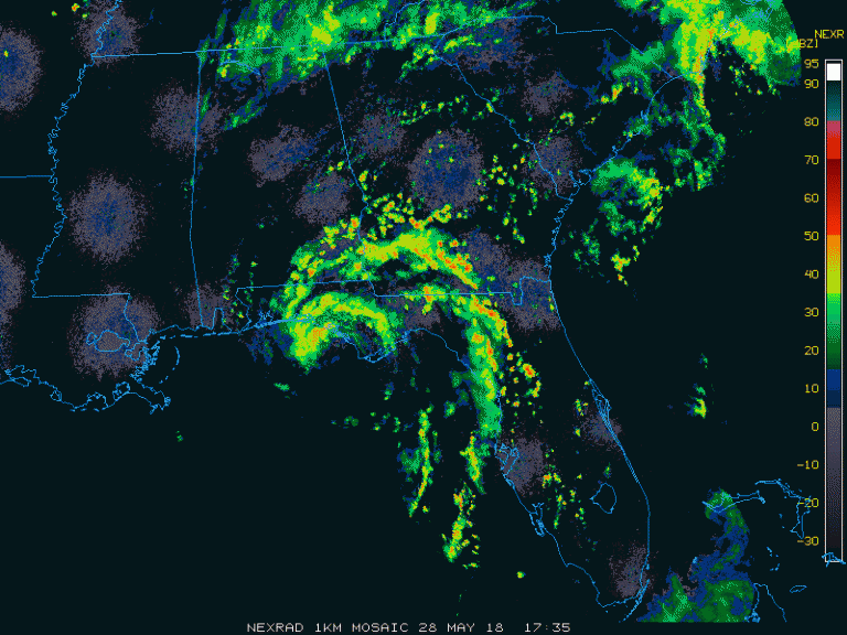
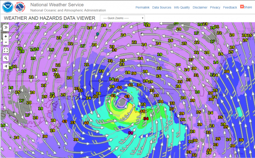
As you can see from the map below of maximum reported wind gusts, the only stations that have reported gusts higher than 50 mph (80 kph) have been over the open Gulf. Some surge flooding and rough surf has occurred to the east of the landfall point. However, the main story is and will continue to be the freshwater flooding threat.
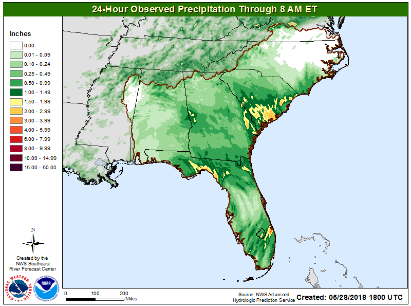
The map below shows rainfall totals over the past 24 hours. The heaviest rainfall amounts of 1-3 inches (25-75 mm) have occurred over scattered areas of Florida and the lowcountry of South Carolina, where convergence of Gulf and Atlantic moisture has enhanced amounts. Going forward (second map below), the biggest threat for flooding rainfall will be along the track of the storm through Alabama and into the Tennessee Valley. A secondary rainfall maximum will be in the southern Appalachians where south-facing terrain enhances rainfall amounts. Three to six inch (75-150 mm) amounts will be common in these areas, leading to significant flooding.