Heat Wave Will Spread to the US Eastern Seaboard By Early Next Week

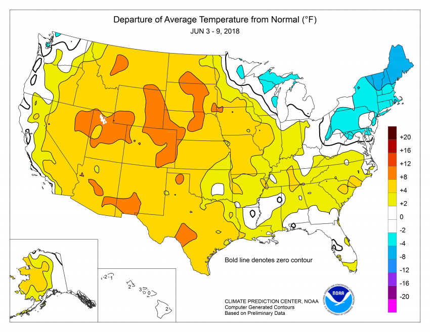
Residents in the east have been lucky so far this spring and early fall. Temperatures well above normal a few months ago have trended downward over the past few weeks (see graphic below). Comfortably mild temperatures have dominated so far this spring, but look for a rapid onset of summer this weekend into early next week.
Heat watches and warnings are already in effect in the Midwest, where highs this weekend should approach 100 degrees with heat index values at dangerous levels. The strong ridge of high pressure responsible for the heat will spread to the East Coast by Sunday into Monday. Highs on Monday are expected to exceed 90 degrees well into the New England states (at least away from the cooling ocean influence). It would be the warmest temperatures in many months if the forecasts are correct. In Worcester, MA, for instance, highs only touched 90 degrees once in summer 2017, on June 12th. This blazing heat will be accompanied by high humidity, leading to health-threatening heat index values well above 100 degrees, even topping 110 degrees in the Mid-Atlantic.
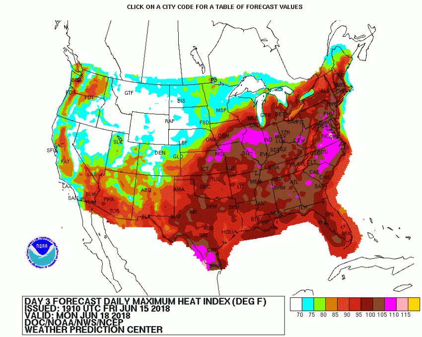
Heat index values above 105 degrees are defined as dangerous with an increased risk for heat cramps and heat exhaustion. Prolonged exposure to these conditions, especially under direct sunlight which can increase the effective heat index as much as 15 degrees, can lead to heat stroke. This is a potentially deadly illness responsible for 600 deaths on average per year in the U.S. If you have outdoor plans this weekend into early next week, drink plenty of fluids, use sunscreen, and take frequent indoor breaks. Lead photo courtesy Air Force Sgt. Sheila DeVera.
