UPDATE: Trami Picking Up Speed, Flooding Rains Imminent for Japan!
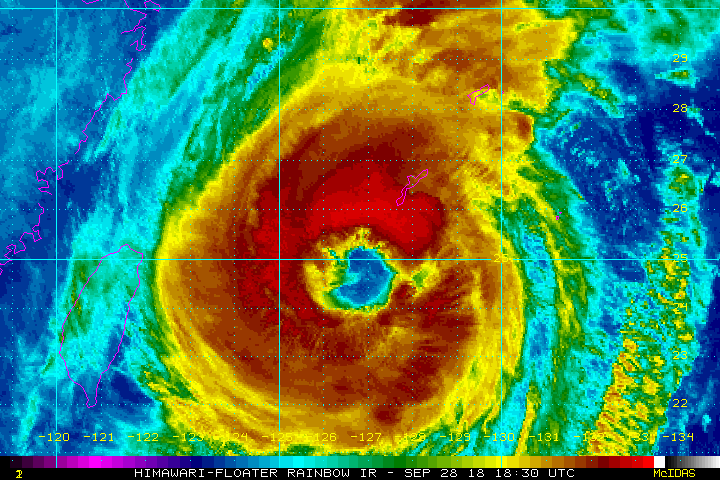
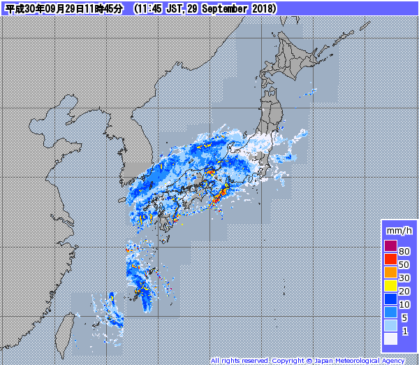
Typhoon Trami is beginning to move more quickly to the north and northeast today. It’ll be raking the Ryukyu Islands through tonight, but the Japanese home islands are next in the crosshairs. Heavy rains have already spread across much of Japan well ahead of the cyclone (see radar image below). Flooding, damaging winds, and a significant storm surge will accompany this ferocious storm over the weekend.
Trami is moving more quickly today. A turn to the northeast is expected later today, bringing Trami into or near southern Japan starting Sunday morning. Acceleration will continue with Trami already exiting the home islands by midday Monday. Pockets of heavy rain have broken out well ahead of the cyclone, however. Winds and waves will be on the increase through Sunday as well. Gusts along the southern coast of Japan will likely approach 85 mph (150 kph) as the cyclone passes through.
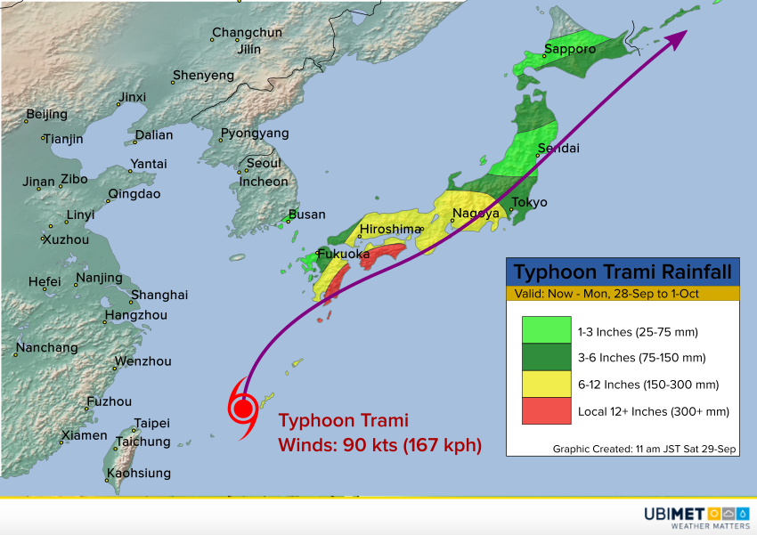
Much of the home islands will see rainfall exceeding three inches (75 mm). Central and southwest sections will see 6-12 inches (150-300 mm), with parts of eastern Kyushu and Shikoku seeing amounts exceeding 12 inches (300 mm). Significant flash flooding will be the result, especially where mountainous terrain enhances runoff. Dangerous mudslides will also occur.
