Surprise Snowstorm Halts Traffic Through the Urban Corridor!
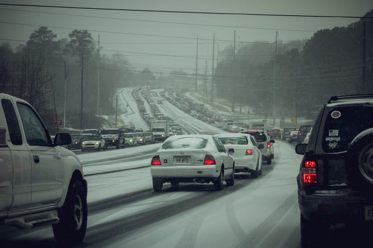
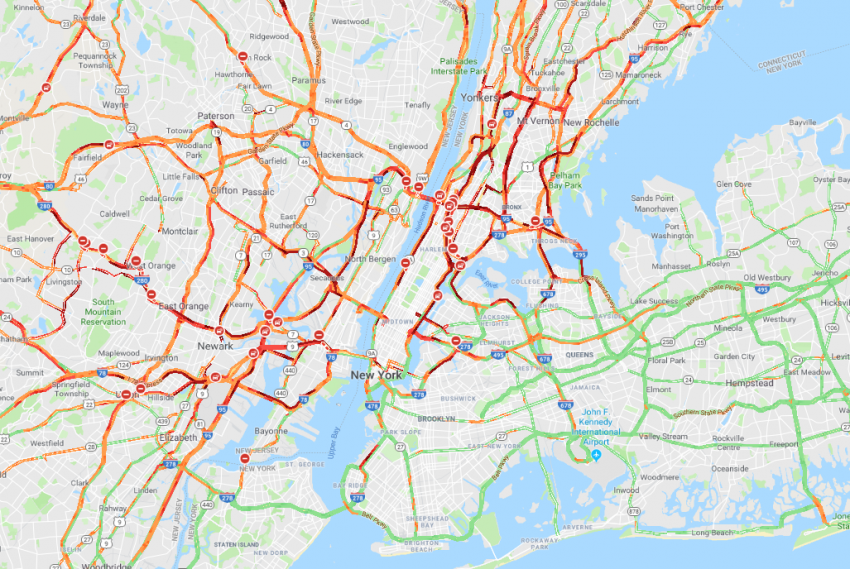
It’s only a matter of a degree or two separating wet but drivable roads and a snowy mess. Unfortunately, Mother Nature decided to give cities along the Eastern Seaboard the “cold” shoulder today. Much heavier snow has fallen than was expected, leading to traffic snarls and power outages from the Midwest to the East coast. The map below shows the deadlocked traffic situation that still exists around the New York City metro as late as 11 pm Thursday evening. Needless to say, officials and commuters across this region are frustrated.
Transportation and transit are the lifeblood of our city. 3 inches of snow have crippled #NYC and this is unacceptable. Moms are stranded with their kids, people are running out of gas. This is unacceptable & we demand answers. #NY13 @NYCSanitation pic.twitter.com/jMZdqOX7m1
— Adriano Espaillat (@RepEspaillat) November 16, 2018
Meteorologists expected temperatures to warm just above freezing as the precipitation moved in earlier on Thursday. This would have meant a mix of sleet, snow, and rain with relatively light accumulations. However, the snow moved in and became heavy quickly, locking near freezing temperatures in for a longer period than anticipated. The snow didn’t last very long but rates exceeded 1″/hr (2.5 cm/hr) in some areas. Below is a map with snow accumulations for the day around the major cities. NOTE: Totals are preliminary in the Boston area since the snow is still falling as of late Thursday evening.
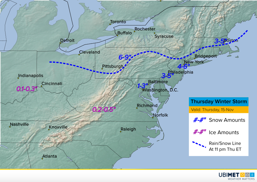
It’s part of the same storm system that dropped major ice accumulations up to 0.5 inch (1.3 cm) over portions of the Ohio Valley and Appalachians late Wednesday into Thursday. Numerous traffic accidents and power outages have been the result. The storm is also producing heavy snows over the interior Northeast. Some of the higher elevations will likely see totals approaching a foot (30 cm) before all is said and down.
