Windy Storms Roll Across Portions of the Plains, Potentially a Derecho Pattern
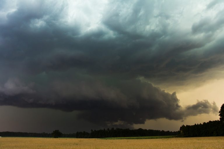
Heat and humidity lingering into the evening hours on Thursday over the Central Plains provided plenty of fuel for severe storms. These storms became a long-lived squall line that has produced damaging winds from Nebraska and Kansas to Illinois.
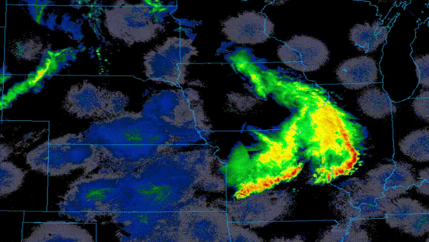
“Derecho” is the name given to a squall line that produces 60 mph (100 kph) winds continuously for a period of at least six hours. Meteorologists typically observe a handful every year, mainly during the summer. The radar signature of the mature derecho is known as a “bow” for its resemblance to the standard archery equipment (see radar imagery above). Some of the most destructive severe weather episodes in the U.S. have been derechos. The derecho that slammed the Midwest and Mid-Atlantic in July 2012 cost nearly $3 billion in damages!
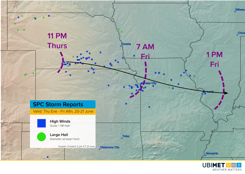
The current squall line easily qualifies as a derecho in terms of wind damage reports and duration (see map above). The squall line spun together on Thursday evening along the western Kansas-Nebraska border. Within the first hour or two it was producing wind gusts commonly in the 80-100 mph (130-160 kph) range. Numerous trees were uprooted and power poles were snapped like twigs. As the night wore on, the derecho lost some energy, but was still producing sporadic reports of damage with gusts 60-70 mph (100-115 kph). These continued through the morning hours. As of Friday mid-afternoon, the line was still tracking through southern Illinois with a damaging wind potential headed for portions of Kentucky and Tennessee. The environment remains favorable for additional squall lines to develop tonight in the Plains and Midwest.
