Barry Continues to Strengthen, Moving Close to the Louisiana Coast!

Tropical Storm Barry remains somewhat organized with dry air disrupting the northern half of the circulation. Nevertheless, aircraft reconnaissance planes continue to find stronger and stronger winds in the core. Damaging winds, a significant storm surge, and especially torrential, flooding rainfall will accompany this dangerous storm!
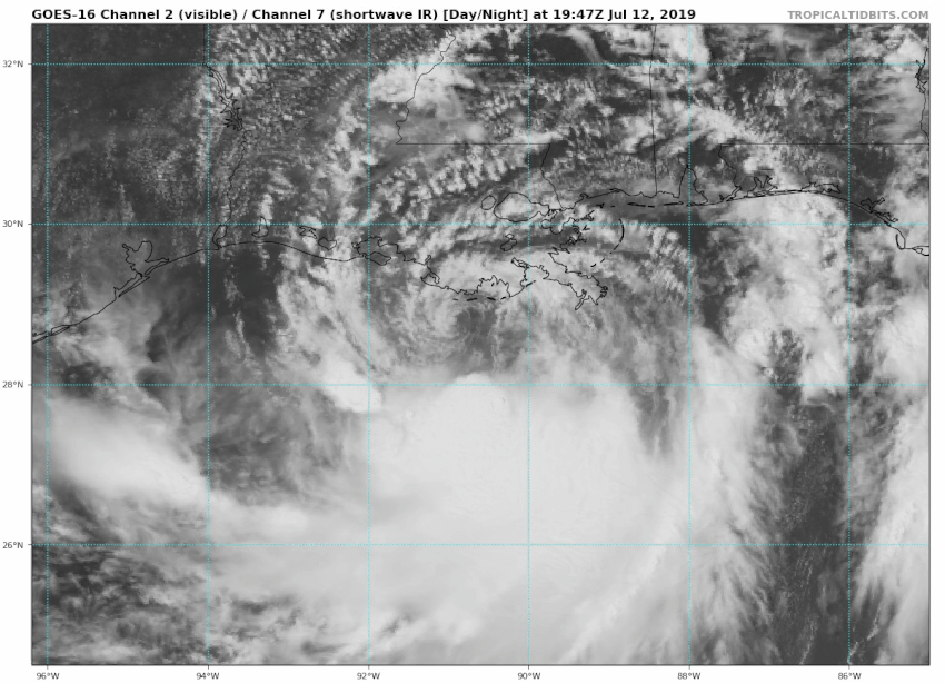
The storm has been moving mainly to the west today, skirting just south of the coast (see satellite animation above). The track has shifted somewhat to the west in model guidance. Landfall is now expected to be closer to Vermillion Bay or Pecan Island. This is a fairly sparsely populated region, and the danger appears to be somewhat less in the New Orleans metro.
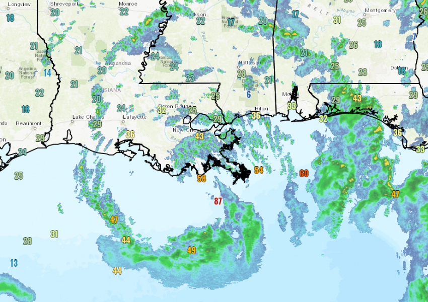
Barry remains a strong tropical storm as of Friday afternoon. However, it still has time to achieve hurricane status before landfall on Saturday. Regardless of whether it does or not, areas along the coast can expect to see high winds downing trees and power lines. The map above shows gusts already exceeding tropical storm force over southern Louisiana. A storm surge up to 5-6 feet in spots will also cause major problems along the central coast of Louisiana.
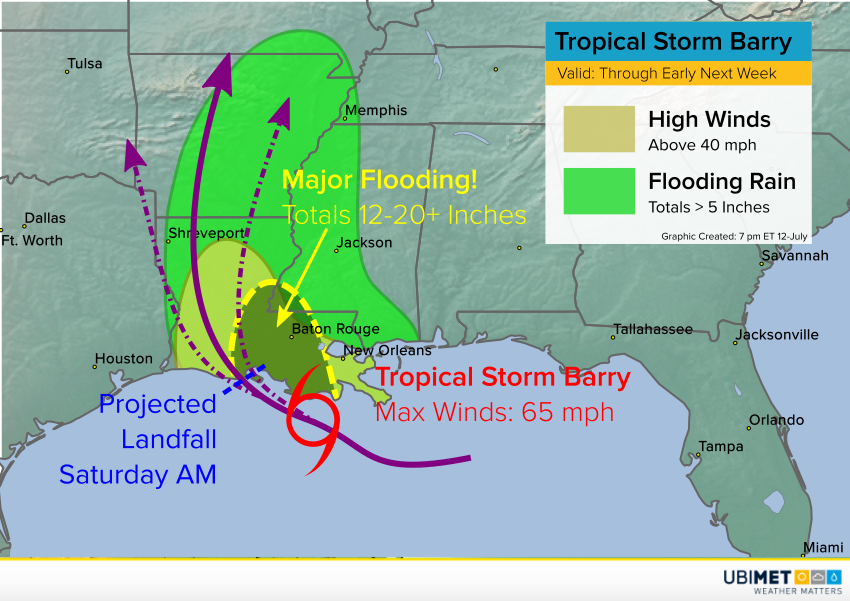
However, the most widespread danger will be from flooding rainfall. Although southern Louisiana has seen a relative break in the past 24 hours, a band of heavy rain is expected to become established over the southeast, especially west of New Orleans. This band will develop on Saturday and persist through Sunday and possibly into Monday. Within the band, totals exceeding a foot will be common, with some spots seeing closer to 24 inches! This copious rainfall will cause already-high rivers to rise even more, including the Mississippi, which is expected to reach the highest levels in nearly 70 years.
