Rapidly Intensifying Hanna Will Be a Hurricane Prior to Texas Landfall on Saturday!

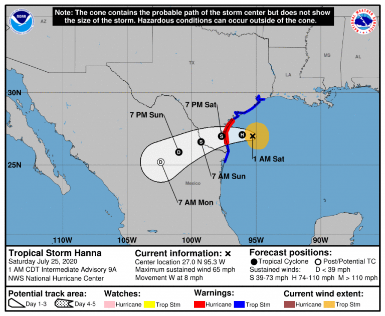
Tropical Storm Hanna is poised to bring hurricane-force conditions to parts of south Texas this weekend. Hurricane hunter aircraft recently found increasing winds near the center, and an eye appears to be forming on satellite imagery. Hanna is undergoing rapid intensification tonight and will likely be a hurricane by daybreak on Saturday. The storm is moving through an area of very warm ocean waters with low shear, classic ingredients for strengthening. Its small size also makes it a prime candidate for sudden fluctuations in intensity. Landfall of this dangerous storm is expected on Saturday afternoon or evening, although conditions will deteriorate quickly as early as Saturday morning.
An eye feature is beginning to warm and grow more apparent on IR imagery as deep convection continues to push upshear and symmetrize around the center. Given current trends, it wouldn’t surprise me if #Hanna is already a hurricane with 15-18 hours still to go before landfall. pic.twitter.com/KtGkuqcmaR
— Tyler Stanfield (@TylerJStanfield) July 25, 2020
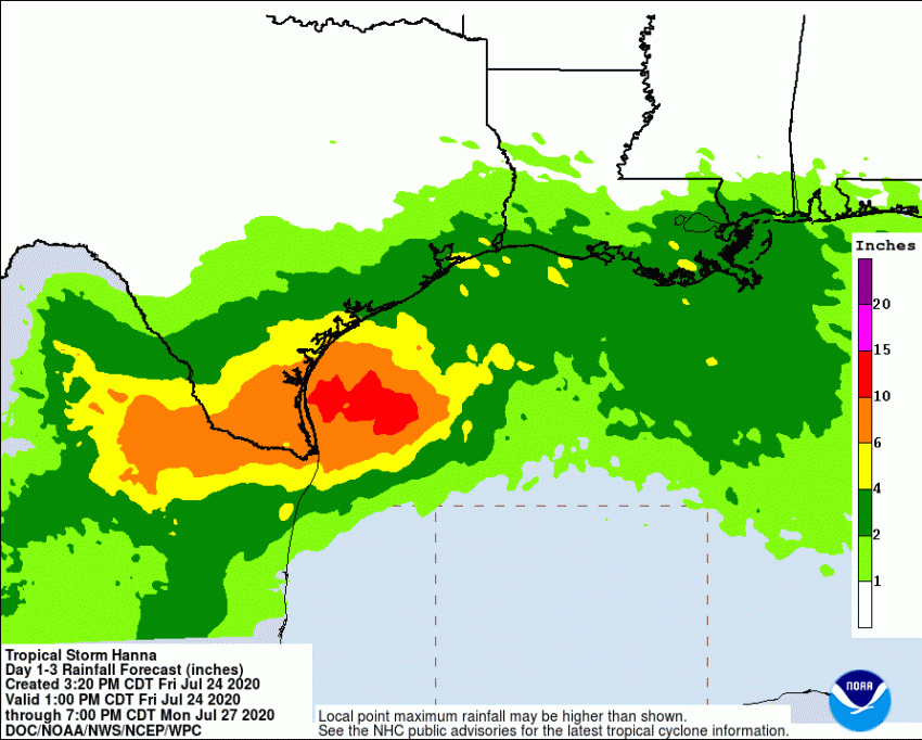
Major population centers such as Corpus Christi, home to nearly half a million residents, will see the worst impacts. These will include destructive winds to 80 mph (kph) and a potentially deadly storm surge locally up to 4-5 feet (m). Flooding rainfall of 5-10 inches (mm) will affect a much larger region of south Texas and northeast Mexico (see map below) with locally higher amounts likely. Weakening will occur as the system moves further inland Sunday into Monday.

